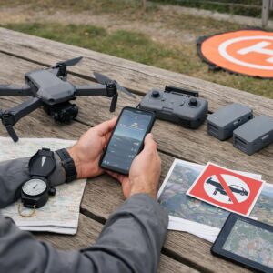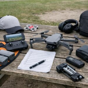
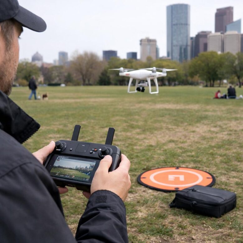
A location that looks open and harmless from the ground may still contain airspace restrictions, park rules, wildlife concerns, privacy issues, signal obstacles, or people who unexpectedly enter the flight area. Safe flying begins by evaluating the complete environment rather than relying on a single map or application.
Parks, cities, and open areas create different operational challenges. Parks often combine land-use rules, visitors, and protected wildlife. Cities add dense obstacles, radio congestion, privacy concerns, and limited landing space. Open areas provide more room but may expose the aircraft to stronger wind, difficult terrain, dust, water, and isolation.
This guide uses United States requirements when discussing specific regulations. Pilots elsewhere should check their national aviation authority, local government, land manager, and property owner before flying.
Start by checking four separate layers
A green area on an airspace map does not automatically mean that the ground below it is available for drone use. Similarly, permission from a property owner does not replace an airspace authorization.
Confirm the rules for the flight purpose, aircraft registration, Remote ID, visual line of sight, altitude, operations over people, controlled airspace, temporary restrictions, and any required pilot qualification.
Check controlled airspace, airports, heliports, prohibited or restricted areas, temporary flight restrictions, emergency activity, and other notices that may affect the planned location.
Verify whether the park, city, state agency, private owner, refuge, beach, trail, or other land manager allows launching, landing, and operating equipment from the property.
Privacy, trespass, noise, harassment, emergency-response, event, and public-safety laws may apply even when the airspace itself is not restricted.
The FAA regulates the national airspace system, while state and local authorities may regulate matters such as land use, takeoff and landing locations, privacy, trespass, and public safety. A responsible flight plan checks both.
Flying in parks
The word “park” can describe very different types of property. A national park, national wildlife refuge, state park, county park, city park, and privately managed recreation area may each follow different rules.
National Park Service locations
In most areas administered by the U.S. National Park Service, launching, landing, or operating an uncrewed aircraft from NPS lands and waters is prohibited unless written approval has been provided.
The National Park Service explains that its jurisdiction generally ends at the park boundary. That distinction does not mean that launching outside a park automatically makes any planned overflight legal or responsible. FAA requirements, other federal laws, temporary restrictions, wildlife protections, and the effects of the flight still need to be considered.
Do not use the phrase “national park” as the only part of the check. National monuments, national seashores, national recreation areas, memorials, historic sites, and other units may also be managed by the National Park Service.
State, county, and city parks
Rules for state and local parks vary considerably. Some allow drones throughout selected areas, some require a permit, some provide designated flying fields, and others prohibit launching or operating drones from park property.
Before visiting, look for:
- The park’s official rules or superintendent notices
- Permit or reservation requirements
- Designated model-aircraft or drone areas
- Seasonal wildlife or fire restrictions
- Opening hours and event closures
- Restrictions on commercial photography
- Rules for parking, trail access, and equipment setup
Save or bookmark the current official rule rather than relying only on an old forum post, video, map label, or verbal comment. When a rule is unclear, contact the agency that manages the specific property.
National wildlife refuges and sensitive habitat
The U.S. Fish and Wildlife Service states that launching, landing, or disturbing wildlife with a drone on national wildlife refuges is prohibited. Individual refuge pages may contain additional local rules.
A drone does not need to strike an animal to cause harm. Noise, repeated approaches, hovering, or following an animal can interrupt feeding, nesting, resting, migration, or care of young.
If birds begin circling, calling, diving, leaving a nest, or repeatedly changing direction because of the aircraft, increase distance and end the flight. Do not use the reaction as an opportunity to capture more dramatic footage.
People and crowds in parks
A public park may change from nearly empty to crowded within minutes. Children, dogs, runners, cyclists, sports groups, and events can enter an area that looked clear during setup.
Do not assume that a small drone may routinely fly over people. Under Part 107, operations over people and moving vehicles are permitted only when the aircraft and operation meet the applicable regulatory category and conditions.
A better park route keeps the aircraft away from playgrounds, sports fields in use, picnic groups, queues, paths, parking areas, and places where people may unexpectedly gather.
Park flight review
- Managing agency and current property rules
- Airspace and temporary restrictions
- Permit or designated-area requirements
- Wildlife closures and nesting seasons
- Events or expected crowds
- Visitors are clear of the route
- No wildlife is reacting to the aircraft
- A safe landing area remains available
- The flight will not block paths or facilities
- Conditions still match the original plan
Flying in cities
Urban flying combines airspace, buildings, antennas, traffic, pedestrians, privacy, limited landing areas, and rapidly changing hazards. A legal flight can still be poorly planned when the route leaves no safe response to a lost link, sudden gust, low battery, or person entering the area.
Check airspace before evaluating the camera shot
Cities often contain airports, heliports, hospital flight routes, controlled airspace, stadium restrictions, government facilities, and temporary restrictions associated with public events or security activity.
In the United States, recreational pilots can use an FAA-approved B4UFLY service for airspace awareness. When controlled-airspace authorization is required and available through the system, use an approved LAANC provider.
An airspace-awareness application is only one part of the check. It does not grant access to private property, cancel a municipal launch restriction, or determine whether recording a person or private area complies with local law.
Urban signal and compass problems
Buildings, power equipment, metal structures, communication systems, reinforced concrete, and congested radio frequencies can affect positioning, compass readings, control links, or live video.
There is no universal rule requiring a pilot to move exactly 200 meters from an interference source. The appropriate response depends on the aircraft, warning, location, and source of the problem.
When unexplained compass, positioning, or link warnings persist, do not repeatedly recalibrate and launch from the same location. Move to a clearer area or cancel the flight. Compass calibration should be performed only according to the manufacturer’s instructions and away from magnetic interference.
Glass can be difficult for obstacle-sensing cameras to interpret and may reflect satellite signals or visual information.
Wires, cables, branches, antennas, and crane lines may be difficult to see in the live feed and may not be detected reliably.
Buildings can create turbulence, downdrafts, and sudden changes in wind direction that are not obvious at the launch point.
Roads, rooftops, fenced property, pedestrians, and traffic may leave few safe alternatives when the planned landing area becomes unavailable.
Obstacle sensing has limits
Obstacle-avoidance systems should be treated as assistance rather than permission to fly close to buildings. Detection may be reduced by low light, reflective surfaces, narrow objects, textureless walls, fast movement, certain flight modes, or obstacles outside the sensor coverage.
Automated flight paths and tracking modes require the same route evaluation as manual flight. The pilot remains responsible for maintaining visual line of sight, avoiding other aircraft, and intervening when the route becomes unsafe.
Privacy and respectful camera use
The FAA does not regulate privacy, but state and local privacy laws may apply. Trespass, harassment, stalking, recording, and other rules can also differ by jurisdiction.
Avoid deliberately pointing the camera into residential windows, enclosed yards, balconies, hotel rooms, medical facilities, schools, or other places where people reasonably expect privacy.
When people appear incidentally in a wide public scene, consider whether they need to be identifiable. Framing, altitude, timing, editing, and blurring can reduce unnecessary collection of personal imagery.
Noise and public interaction
Drone noise can affect residents, animals, outdoor events, ceremonies, performances, and people who are trying to enjoy a public space. There is no universal five-minute hovering rule that makes an operation acceptable.
Reduce repeated passes, avoid prolonged hovering near the same home or group, and choose a route that completes the intended shot efficiently. When someone raises a reasonable concern, landing and discussing the situation calmly is often safer than attempting to argue while the aircraft remains airborne.
City flight review
- Controlled airspace and temporary restrictions
- People and moving vehicles
- Privacy and local property rules
- Compass or radio interference
- Buildings, cranes, wires, and glass
- Use a controlled launch area
- Keep the route short and visible
- Identify multiple landing options
- Avoid windows and private spaces
- Cancel when warnings remain unresolved
Flying in open areas
Fields, beaches, deserts, farms, and remote landscapes may provide more room, but open space should not be confused with an absence of risk. Wind, terrain, water, dust, livestock, wildlife, private property, and limited communication can make recovery difficult.
Wind can be stronger away from surface shelter
Trees, vehicles, dunes, cliffs, and buildings can shelter the launch point while stronger wind exists above or beyond them. Consider average wind, gusts, direction, terrain, and the route back to the landing area.
A long outbound flight with a tailwind may require substantially more energy to return into a headwind. Manufacturer wind-resistance figures describe tested capability and should not be treated as an everyday target.
Use a conservative operating margin for the exact aircraft. If the drone struggles to hold position during a low test hover, drifts unexpectedly, or requires unusually high power to make progress, land rather than continuing farther away.
Terrain can block both vision and signal
Hills, ridges, cliffs, trees, and changes in elevation can block the direct path between the controller and aircraft. A transmission system that performs well over flat ground may lose quality much sooner when terrain sits between the pilot and the drone.
Do not solve a terrain problem simply by climbing without checking altitude limits and airspace. A better plan may be to relocate the pilot, shorten the route, or use a legal position with a clearer line of sight.
The aircraft should remain within visual line of sight. FPV goggles or a live video feed do not remove this requirement. Follow the observer and communication requirements that apply to the type of operation.
Beaches, sand, dust, and water
Loose material can be pulled into motors or strike the camera and sensors during takeoff and landing. A clean, weighted landing pad can reduce exposure to sand, soil, dry grass, and small stones.
Routine hand catching introduces a propeller-injury risk and should not be presented as the default solution for sandy areas. Use it only when the manufacturer permits the procedure, the pilot has appropriate training, and the situation can be managed safely.
Over-water flights need additional battery and route planning. Reflections, low-texture surfaces, waves, spray, and changing wind may affect sensors or pilot judgment. Many consumer drones are not waterproof.
Private property, farms, and livestock
Obtain permission before entering, launching from, or landing on private property. Do not assume that an open field is public simply because it lacks a fence.
Avoid low or repeated passes near cattle, horses, sheep, or other animals. There is no universal altitude such as 150 feet that guarantees livestock will not react. Species, herd behavior, terrain, noise, and previous exposure all matter.
If animals become alert, cluster together, run, change direction, or show distress, increase distance and end the flight.
Isolation requires a separate emergency plan
Remote locations may have poor mobile service, difficult roads, extreme temperatures, and long emergency-response times. Tell a trusted person where you are going and when you expect to return.
Useful preparation may include:
- An offline map of the area
- Extra drinking water and weather-appropriate clothing
- A first-aid kit
- A charged phone or suitable emergency communication device
- A plan for vehicle access and road conditions
- A clear point at which the flight or trip will be abandoned
Open-area flight review
- Wind and gust direction
- Terrain between pilot and aircraft
- Sand, dust, water, or vegetation
- Wildlife and livestock
- Temperature and approaching weather
- Landowner or site permission
- Reliable return route
- Battery reserve for headwind
- Alternative landing areas
- Emergency communication plan
Rules that apply across all three environments
| Requirement or practice | What it means in practice | Common misunderstanding |
|---|---|---|
| Visual line of sight | Maintain the ability required by the applicable rules to see the aircraft, understand its position and direction, and scan for hazards. | A strong video feed does not automatically permit beyond-visual-line-of-sight flight. |
| Altitude limits | Confirm the limit for the operation, airspace, and location. Recreational Class G flights are generally limited to 400 feet above ground level. | “Below 400 feet” does not make every location or route legal. |
| Airspace authorization | Receive authorization before operating in controlled airspace when it is required. | Submitting a request is not the same as receiving approval. |
| Operations over people | Avoid unnecessary flight over people. Under Part 107, the applicable aircraft category and operating conditions must be satisfied. | A lightweight drone is not automatically allowed to fly over any crowd. |
| Battery reserve | Plan enough energy for wind, distance, temperature, route, landing, and unexpected delay. | There is no universal 25% return point that is safe for every flight. |
| Weather | Review current conditions and continue monitoring them during the operation. | A forecast checked the previous evening may not describe conditions at takeoff. |
| Right of way | Yield to crewed aircraft and land when necessary to avoid conflict. | A drone’s small size does not give it priority at low altitude. |
Choose the decision before pressure appears
Travel time, good lighting, a client deadline, or a rare view can make a pilot more willing to continue after conditions have changed. Define the decision criteria before takeoff.
Rules are confirmed, the area is controlled, conditions are within a conservative limit, and a safe return remains available.
People enter the route, wind increases, the home point looks incorrect, wildlife appears, or a warning needs investigation.
Authorization is missing, visibility is lost, interference persists, emergency aircraft are nearby, weather deteriorates, or safety cannot be maintained.
Do not fly near wildfires, active police incidents, rescue operations, accident scenes, or other emergency activity. A drone can force crewed public-safety aircraft to stop operating and can place responders and the public at risk.
Location safety checklist
- Flight purpose and applicable rules confirmed
- Airspace checked through a current official source
- Required authorization received
- Temporary restrictions checked
- Land manager or property rules reviewed
- Launch and landing permission confirmed
- Wildlife and seasonal closures reviewed
- People and vehicles assessed
- Privacy-sensitive areas identified
- Obstacles inspected in person
- Wind and gusts checked
- Terrain and signal path reviewed
- Primary landing area available
- Alternative landing area identified
- Home point verified
- Return route and altitude reviewed
- Battery reserve matched to conditions
- Emergency activity ruled out
- Visual line of sight can be maintained
- Clear landing conditions established
Frequently asked questions
Can a drone be flown in a national park if it launches outside the boundary?
The National Park Service generally controls launching, landing, and operating from NPS lands and waters, and its jurisdiction normally ends at the park boundary. However, launching outside does not automatically make a planned flight lawful or responsible. FAA rules, temporary restrictions, other federal laws, wildlife disturbance, and the effects of the operation still need to be evaluated.
Does a “No Drone Zone” sign close the airspace?
Not necessarily. The FAA explains that state, local, or private signs commonly concern takeoff and landing from the property rather than control of the national airspace. The underlying law, property authority, and any separate FAA restriction should be checked.
Is flying in an empty city park safe?
An empty field reduces some risks but does not resolve airspace, park permission, privacy, wildlife, interference, temporary restrictions, or the possibility that visitors may enter the area.
What should a pilot do when a bird approaches the drone?
Avoid chasing or repeatedly maneuvering around the bird. Increase separation, move away from nesting or feeding areas, and land as soon as it can be done safely. Do not continue filming an animal that is reacting to the aircraft.
Is open countryside always uncontrolled airspace?
No. Rural and remote locations may still contain controlled, restricted, prohibited, military, temporary, or special-use airspace. Check the current airspace status before every flight.
Should the drone return when the battery reaches 25%?
A fixed percentage cannot account for wind, distance, temperature, battery health, terrain, or available landing areas. The return decision should preserve a meaningful reserve for the specific route and conditions.
The safest location is not simply the place with the most open space. It is the place where the rules are clear, the pilot can maintain visual awareness, people and wildlife are protected, weather remains within a conservative limit, and the aircraft has a reliable route back to a controlled landing area.
Official references
- FAA — Recreational Flyers and Community-Based Organizations
- FAA — Certificated Remote Pilots and Part 107 Operations
- FAA — B4UFLY airspace-awareness services
- FAA — State and Local Regulation of Unmanned Aircraft Systems
- FAA — What to Know About Drones
- National Park Service — Uncrewed Aircraft in the National Parks
- U.S. Fish and Wildlife Service — Uncrewed Aircraft Systems
- U.S. Fish and Wildlife Service — Keeping Wildlife Safe from Drones
Dflyco Editorial Team creates practical, well-researched content about drones, aerial photography, flight safety, and responsible drone use. Our articles are reviewed using official documentation, manufacturer specifications, and trusted aviation sources to help readers make informed decisions.